
DATA, NOT STREET VIEW
How the Hop Earth map works
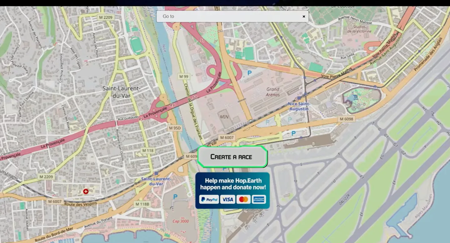
Hop.Earth combines OpenStreetMap road geometry with separately attributed elevation sources and browser-side game generation. The result is playable geography, not a photographic copy of the real road.
Reviewed and updated August 25, 2026
Three Hop Earth map layers
Road geometry
OpenStreetMap contributes community-mapped road lines, connections, and feature data.
Elevation
Official attribution lists global and regional terrain datasets.
Game generation
The browser client converts those inputs into surfaces, terrain, and vehicle simulation.
Why a familiar road can look unfamiliar
A map database describes features but cannot provide a surveyed racing surface. The game must simplify width, camber, junctions, objects, and separated road levels.
- Tunnels and bridges may meet terrain imperfectly.
- Complex multi-level highways can be difficult to separate.
- Small tracks may be unsuitable for vehicles.
- Recent mapping changes may wait for upstream refreshes.
Choose locations that generate well
Begin on a connected main road, avoid the most complex interchanges, and let elevation and road tiles finish before calling the vehicle.
Read Hop Earth as generated geography, not imagery
The official public repository identifies OpenStreetMap as the source of road geometry. That geometry describes mapped lines, connections, classifications, and related features, but it is not a photographic road surface or a complete engineering survey. Hop Earth converts those inputs into a playable environment. A road can therefore follow a recognizable real-world direction while its width, camber, barriers, lane detail, roadside objects, or junction shape differs from what a driver would see in person.
This distinction matters when choosing and judging locations. A social description such as driving on Google Maps is an informal comparison, not the data source described by the project. Search using real place names and coordinates, but evaluate the generated result as a game world. Do not expect storefronts, traffic signs, exact building models, or current street closures. The useful promise is geographic inspiration and connected-road play, not visual or navigational identity with a commercial street-view product.
Understand how elevation changes the result
Road lines need terrain height before they can become a convincing 3D drive. The public project description says production uses processed digital elevation data, including global and regional sources where applicable. Elevation samples have different resolutions, coverage, update schedules, and treatment near coastlines or engineered structures. The game must combine those samples with mapped roads, which can create steep joins, floating or buried segments, simplified cuttings, or unusual transitions around bridges and tunnels.
Mountain routes make elevation strengths and limitations especially visible. Wait for terrain to settle before summoning the vehicle, approach sharp grade changes at moderate speed, and keep the reset action available. A road that looks broken at one point may generate better from a nearby start, while a complex stacked interchange may remain difficult because several road levels occupy nearly the same horizontal position. Use the route generator’s difficulty label as a planning signal, not a guarantee that every tile will form a smooth racing surface.
Choose roads that are likely to generate cleanly
Broad connected roads with moderate terrain and ordinary junctions are the safest starting points. City avenues, major coast roads, and simple highways usually provide clearer geometry than footpaths, service lanes, ferry links, dense parking layouts, or extremely complicated motorway ramps. Start away from the most complex feature, prove the car and controls, and then drive toward it. This creates a usable fallback if the difficult section does not generate as expected.
Coordinates help when names are ambiguous, but a coordinate can still land beside the intended carriageway or on another vertical level. Inspect the visible network and reposition slightly rather than assuming the first pin is perfect. If one road repeatedly fails, compare a nearby main road before changing devices. Success nearby suggests a local data or generation issue; failure across several simple locations points toward loading, graphics, account, or service state instead.
Interpret map differences responsibly
OpenStreetMap is maintained by contributors, and mapped features can change. The official service also controls when and how source data is processed for production, so a recent map edit may not appear immediately. This guide cannot promise a refresh schedule. When reporting a discrepancy, provide the location, coordinates, visible result, and the date checked. Separate a missing road line from a road that exists but generates with unusual terrain, because those observations concern different parts of the data and rendering chain.
Do not use the generated game world for real navigation, safety decisions, access permissions, or current road conditions. A playable connection does not prove that a road is public, open, safe, legal, or physically unchanged. Use authoritative navigation and local information for real travel. Within the game, treat differences as route-selection information: choose another start, slow down near uncertain terrain, or select a reviewed road that has a simpler geometry profile.
Build a personal map-quality checklist
Before committing to a long drive, check that the start and destination sit on connected roads, the terrain has settled, major junctions are visible, and the first vehicle test succeeds. Note bridges, tunnels, coast edges, or steep grade changes that may require slower driving or a nearby alternate start. This checklist does not guarantee perfect generation, but it turns map inspection into a useful player decision instead of a visual guess. Over time, saving reliable coordinates gives you a small collection of dependable routes for testing updates, devices, and multiplayer sessions.
How the Hop Earth map works field notes
The road network comes from mapped data
The official public repository identifies OpenStreetMap as the road-geometry source. Mapped lines, connections, and classifications provide useful structure, but they are not a surveyed driving surface or a street-level photograph.
Elevation is a separate input
The public project description says production uses processed digital elevation data, including global and regional sources where applicable. Combining road lines with terrain samples can produce steep joins, simplified bridges, or unusual multi-level junctions.
Generation makes the world playable
The browser client turns source data into surfaces, terrain, objects, and vehicle simulation. That transformation explains why a familiar place can feel recognizable in layout while road width, camber, barriers, buildings, and scenery differ from reality.
For the next step, compare the current Hop Earth controls, choose a reviewed route, or follow the loading and graphics checklist.
DIRECT ANSWERS
FAQ: How the Hop Earth map works
Does Hop Earth use Google Maps?
No. The official public repository identifies OpenStreetMap for road geometry and separately attributed elevation data.
Are Hop Earth roads real?
They are generated from mapped real-world road geometry, then simplified and converted into a playable 3D environment.
Why does my road look different from real life?
Map data and elevation do not contain every surveyed surface detail, so the game approximates width, camber, objects, buildings, and junction levels.
Why do bridges or tunnels look wrong?
Separating roads from terrain and from other road levels is difficult when source geometry or elevation is incomplete or simplified.
Which locations generate best?
Broad connected roads with moderate terrain and straightforward junctions are usually the easiest first choices.
Can map data change over time?
Yes. OpenStreetMap and project processing can change, but production refresh timing is controlled by the official service.